Your order is being processed.
Please do not leave this page

The surroundings of a property play a decisive role for the increase in its value and the feel-good factor. However, such plans are also beneficial in order to record larger projects and the conditions as well as the infrastructure of a location. In addition, these plans are used to create legal frameworks for development. One thing all plans have in common is that they are all graphic representations of a property, a street, a neighborhood, all the way to an entire city. In the following, we have listed what types of plans there are and what distinguishes a site plan from a location plan and a development plan, and how maps relate to them.

Several types of plans are combined under the term site plan. There is the official site plan, which is part of building applications in Germany. The development plan is the first source of information for possible construction measures. The site plan serves as an overview for new construction areas, housing estates and single-family houses.
The development plan is a site plan drawn up by the municipality, in which it is determined what, where and in what form may be built in a defined area. Among other things, it determines whether and how much of a plot of land can be built on and whether a residential building, an office or even an industrial plant can be erected on the plot. Development plans can be used as the first point of reference to obtain information about the building potential of a plot of land.
The official site plan, on the other hand, is an important component of a building application. A building application must always be prepared and submitted to the responsible building authority if a new property is to be built or extensive alterations are to take place. Sometimes it may already be necessary to submit a building application for the installation of dormer windows. In such cases, the regulations of the municipalities in Germany differ greatly from one another. The official site plan consists of a graphic and a written part. The plan explains in detail the planned construction measures as well as the responsibilities.

In addition to these official site plans, other types of site plans have become established for marketing of real estate. These are used for the sale of single-family houses and apartments. But even within a property, a site plan can help a potential buyer or tenant understand how the home is located and whether he or she will be comfortable in that setting. Especially for larger apartment complexes or multi-family buildings, a site plan from the outside as well as sometimes from the inside is of advantage.
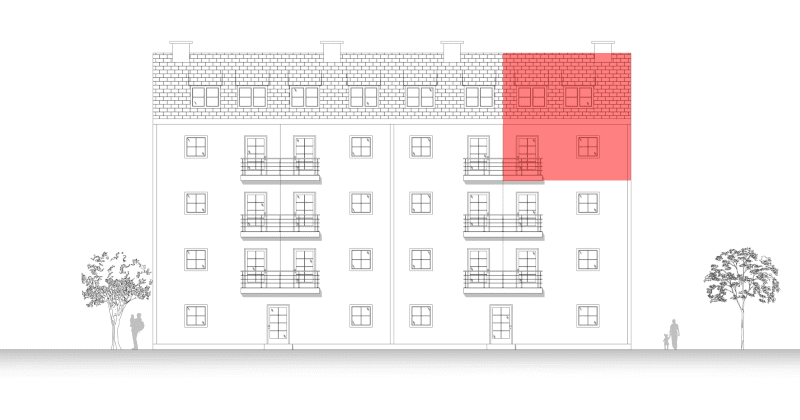
With the site plan from the outside, the apartment is graphically marked on the exterior views. This way, the value of recognition is much higher during the visit, since the prospective buyer can already see where the apartment is located when turning into the street. In our example, you can see how the maisonette apartment for sale was marked in a 16-party apartment building. In this way, potential buyers can see directly where the apartment is located in the building and can already guess what potential the apartment has.
The floor plan shows the entire floor of larger residential complexes and graphically marks the corresponding apartment. For the floor plan, the entire floor or the relevant part of the building is drawn. Details such as the bathroom interior or furniture are not shown here.

With the site plan from the outside, the apartment is graphically marked on the exterior views. This way, the value of recognition is much higher during the visit, since the prospective buyer can already see where the apartment is located when turning into the street. In our example, you can see how the maisonette apartment for sale was marked in a 16-party apartment building. In this way, potential buyers can see directly where the apartment is located in the building and can already guess what potential the apartment has.

The floor plan shows the entire floor of larger residential complexes and graphically marks the corresponding apartment. For the floor plan, the entire floor or the relevant part of the building is drawn. Details such as the bathroom interior or furniture are not shown here.


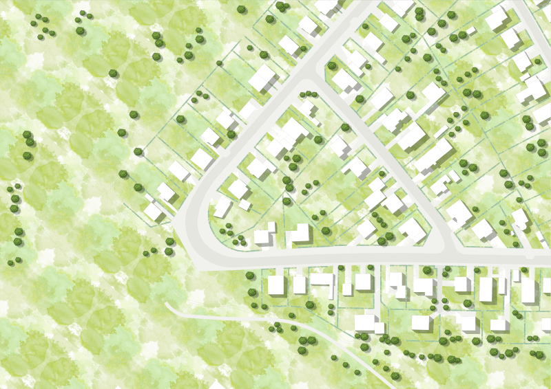
The surrounding plan, for the even clearer presentation of real estate, compares very well with a drawn aerial photograph. From a bird's eye view, the surroundings of the property become clear. Often, surrounding area plans are complemented by further information. For example, distance information to the nearest schools, shopping facilities and the highway can help potential customers to take a closer look at a real estate offer.
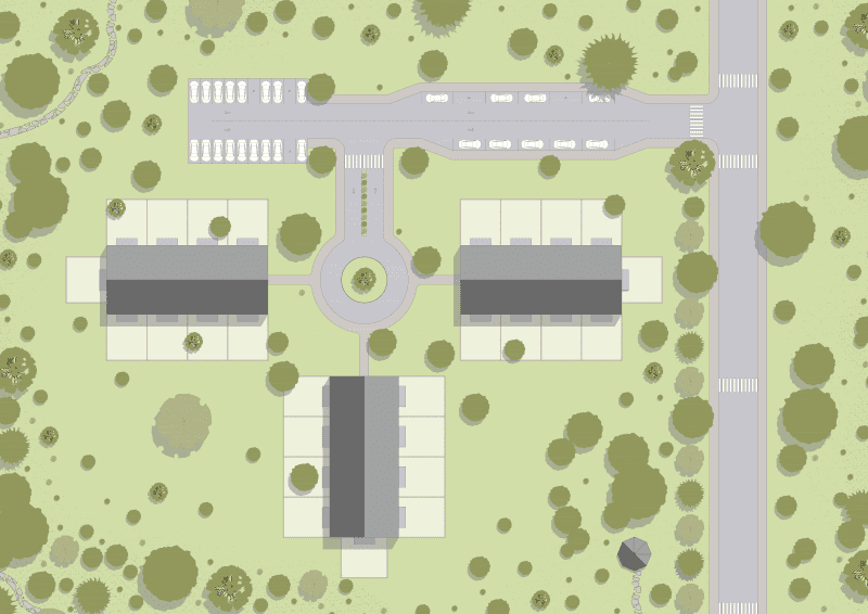
The surrounding area plan for newly developed areas represents a product of its own. Here, it is usually not important to highlight a specific property, but rather the entire area. It then also quickly becomes clear how the infrastructure, roads and streets, are laid out. But also the location of a perhaps planned playground becomes visible from it. This information plays a major role, especially for young families, and can contribute to a decision to buy or rent. Such location maps are often used at the beginning of a presentation of a new development and give a first good overview of the planned project. These maps can then be complemented by color-coding and highlighting the properties that are specifically available for marketing.


For a larger geographical overview and the classification of the real estate situation in the urban area, classic city maps and maps of the surrounding area in various scales are ideal. For the production of classic exposés and for the interactive use of map material on websites, we are happy to recommend our cooperation partner mapz.com, mapz.com, which specializes in city plans and maps as well as geographic information systems (GIS).
Visit themapz-Downloadportal for instant map downloads and further information on interactive maps

For the creation of a site plan or environment plan, we will gladly provide you with a non-binding offer. Simply send us an e-mail to mail@grundriss-schmiede.de and send us your template directly. We are looking forward to your order!